
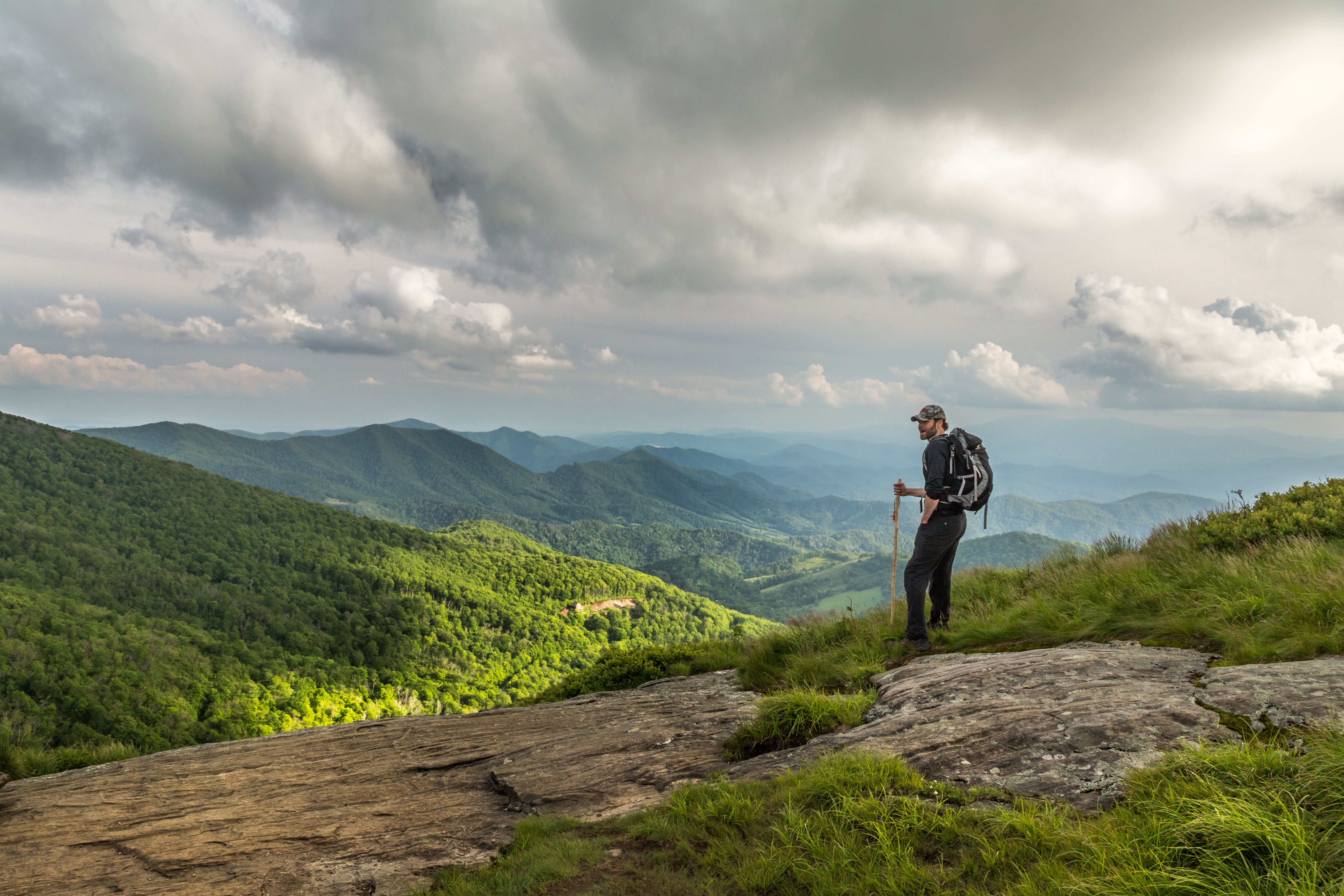
Is hiking or backpacking your thing? Then you’ll love the mountain trails found in our region. Centered in the middle of the three tallest peaks in North Carolina, Mitchell County has spectacular ridges and valleys that are perfect for hiking for those who enjoy spending time outdoors.
Of course you’ll want to start on the Roan Mountain Trails. Roan Mountain and the Roan Mountain Highlands straddle the North Carolina/Tennessee border just a few miles outside of Bakersville. There are several trails that roam through the park’s forests and stretches of Grassy Balds. Hikers in the know will recognize the famous Appalachian Trail that crosses Roan Mountain. The top of the mountain is open from April through October. Roan Trails include the Cloudland Trail, Gardens Trail (the world’s largest Rhododendron Gardens in the world) and the Appalachian Trail.
Visit the Ranger station inside the Museum of NC Minerals at Milepost 331 on the Blue Ridge Parkway. Local National Park Service rangers can assist you with hiking maps and the Mitchell Chamber Visitor Center, located at the Museum can also assist you with brochures, maps, and more.
What Do Others Say About Our Hiking Spots?
7 of the Best Sunset Summits in WNC/Roan Mountain (Blue Ridge Outdoors Magazine)
10 Short and Sweet Fall Hikes in NC with a Spectacular End View (Only in Your State)
If There Are Only 5 Hikes You Do in NC Make Them These (Only in Your State)
The Hiking Trail Hiding in NC That Will Transport You to Another World (Only in Your State)
10 Trips to Make A Backpacker for Life/Roan Mountain, NC (Backpacker.com)
Best of the Blue Ridge, Best Section of the Appalachian Trail/Roan Mountain (Blue Ridge Outdoors Magazine)
2017 Bucket List: 17 Places You Should Go in NC in 2017/Roan Mountain (Only in Your State)

Hiking The Roan
Getting There
Roan Mountain is not one mountain, but a five-mile ridgetop that ranges in elevation from a lofty 6,286 ft. at Roan High Knob to a low of 5,500 ft. at Carver’s Gap, near Bakersville. The Appalachian Trail crosses the grassy summits and affords wonderful panoramic mountain views during the ridgetop hike. It’s famous for the massive native Catawba Rhododendron display of blooms each June. The unique terrain also creates a rare and beautiful ecosystem.
Travel NC Highway 226 N to Bakersville from Spruce Pine, then just “7 miles to heaven” to reach Carver’s Gap and Roan Mountain.
There are two distinct sections to explore Roan. For the best hiking, park at Carver’s Gap near the North Carolina / Tennessee state line and hike east (across the road) atop the grassy summits of Round Bald, Jane Bald and Grassy Ridge – five miles round-trip. Or drive two miles from Carver’s Gap into the Roan Mountain Recreation Area ($3/car, open summer months), part of Pisgah National Forest, for a picnic area, restrooms, paved half-mile trail through rhododendron gardens and a hike to Roan High Bluff overlook. (Romantic Asheville)
Easy Options
Roan Mountain Gardens Trail: Once inside the recreation area, go southwest. This trail offers a paved, accessible loop with small hills and knolls that takes hikers through a natural rhododendron garden. Wooden platforms allow for spectacular views of the gardens and Roan Mountain. This handicap-accessible trail allows everyone, regardless of mobility, to see the beauty and wonder of the rhododendrons and the mountain. More info: National Recreation Trails
Roan High Bluff: Once inside recreation area, take summit road, ends at picnic area. Only .5 of a mile of trail, and it is partially paved. Perfect for anyone who just wants to take in the beautiful view, but needs minimal walking. More details: Roan High Bluff/Cloudland Trail
Tom’s Creek Falls: Located between Marion and Little Switzerland (near Linville Caverns) is Tom’s Creek Falls. This beautiful, 80-ft. multi-cascade waterfall in the Pisgah National Forest is an easy one-mile round-trip hike. And, the hiking trail is just a 1.2-mile drive from US Highway 221. Since it’s so easy to reach and there’s a new observation deck, this waterfall is great for children or adults that cannot walk long distances. For more details: Tom’s Creek Falls
Moderate Segments
Appalachian Trail: With portions of the Appalachian Trail intersecting Roan Mountain, this gives hikers the perfect opportunity to hike on both the AT and Roan Mountain trails. Carver’s Gap, part of the Appalachian Trail, has a .75 mile moderate hike to Round bald, a very large flat bald which has breathtaking views from angles.
Cloudland Trail: Park at the first parking lot, this trail takes you through beautiful forests, has access to the rhododendron gardens, the picnic area and Roan High Bluff. If you see the gardens and hike up to Roan High Bluff, this is a 2 mile trail (4 miles roundtrip). More details: Cloudland Trail
Jane Bald: Jane Bald via Appalachian Trail is a 2.6 mile moderately trafficked out and back trail located near Bakersville, North Carolina that features beautiful wild flowers and is rated as moderate. The trail offers a number of activity options and is best used from April until September. Dogs are also able to use this trail.
Difficult Segments
More AT Trails: From Carver’s Gap, you can access several more difficult hikes that take you along the Appalachian Trail. Roan High Knob is accessible by these trails and is just a bit higher than the Roan High Bluff. If continue hiking, you will reach the balds at Carver’s Gap, beginning with the Round Bald. Go on up to the Jane Bald, which is just past Round Bald, and sports spectacular views and less crowds.
Grassy Ridge Bald, Yellow Mountain Little Hump and Big Hump: extra balds and trails that are accessible after hiking to the Balds at Carver’s Gap. ( Information from https://www.hikewnc.info/trailheads/roan-mountain/)
Carvers Gap to Roan High Knob: Hike to Roan High Knob on the Appalachian Trail from Carvers Gap, climbing through a mossy, fir-filled forest to beautiful Roan Mountain views. Get great details on this hike here from Asheville Trails.com
Carvers Gap to Yellow Mountain Barn: Carvers Gap to Yellow Mountain Barn is a 12.3 mile lightly trafficked loop trail located near Bakersville, North Carolina that features beautiful wild flowers and is rated as difficult. The trail is primarily used for hiking, camping, and backpacking and is best used from March until October. Dogs are also able to use this trail but must be kept on leash. Download map here from AllTrails

Exploring Blue Ridge Parkway Trails
Crabtree Falls: Beginning at the Blue Ridge Parkway campground, this looping hiking trail is 3 miles round trip. This hike includes a 480 foot total elevation gain, with its starting point at the Crabtree Meadows Campground Milepost 339.5. This hike features a stunning 70’ waterfall, beautiful forests and allows you to hike on the trail right beside of a stream. This moderate-to-strenuous hike will give you a real appreciation for the beauty that is Mitchell County. More info here.
Wiseman’s View: 20 minutes off of the Blue Ridge Parkway, Wiseman’s View offers an overlook of the Linville River Gorge, as well as a view of Hawksbill Mountain and Table Rock. This is also one of the premier spots for viewing the “Brown Mountain Lights”, a mysterious nighttime phenomenon. More info here.
Duggers Creek Trail: Starting from mile marker 316.4 on the Blue Ridge Parkway, this 0.4 mile easy hiking trail features views of a small waterfall and is great for families and people of all ages. This is also the perfect trail for bringing your dog along. More info here
Chestoa View Trail: Starting from mile marker 320.8 on the Blue Ridge Parkway, this 0.9 mile loop trail is one of the more popular trails in the area that features beautiful wild flowers and is perfect for families, kids, and people of all skills and ages. More info here.
Camp Creek Overlook and Trail: Starting from mile marker 315.5 on the Blue Ridge Parkway, this 0.1 mile trail is just perfect for stretching your legs after a long scenic car ride through the Blue Ridge Mountains. This trail lead beside Camp Creek and lets you hear the soothing sounds of the creek, and has lots of laurel and rhododendron bushes for viewing.
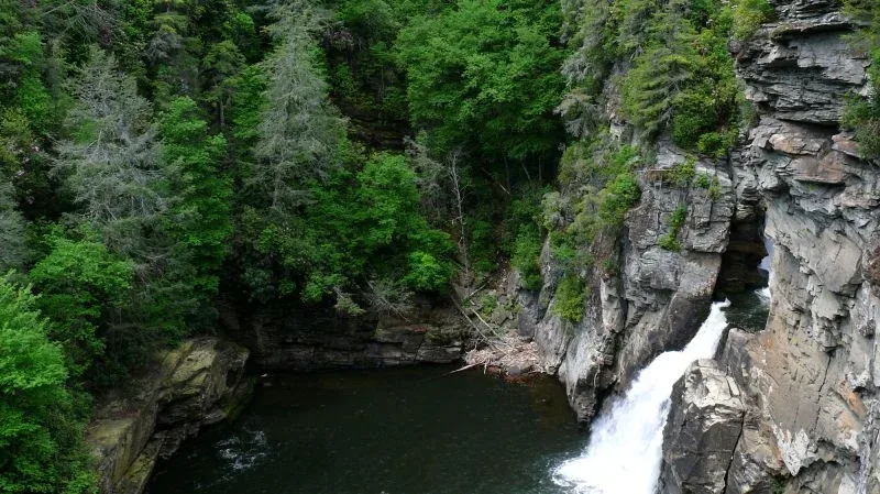
Linville Falls
Upper Falls Overlook: Beginning at the Linville Falls visitors center, follow the main trail and continue to head uphill for.4 miles from the visitors center, making a left to access the Upper Falls Overlook. This trail and overlook has views of a small double waterfall, and you are able to see the deep “s” shaped curve at the top of Linville Falls.
Chimney View: Beginning at the visitors center, follow the main trail and continue to head uphill for .4 miles, making a turn at the sign, and go another .3 miles for a fantastic view of Linville Falls. This 1.4 mile roundtrip trail overlooks the grandeur and majesty of the falls and the gorge.
Erwin’s View: 1.6 miles round trip, this hike will give you the birds eye view of Linville Falls that you have been looking for. This overlook has a more distant view of the waterfall, but also allows you to see the mountains surrounding the falls from an elevation of 3330’.
Linville River Bridge Trail: Beginning at mile marker 316.5 on the Blue Ridge Parkway, this 0.1 mile leg stretcher has a view of a very unusual bridge and is an easy hike.
Little Switzerland Trails
Grassy Creek Falls: This 2 miles round trip trail leads to a beautiful waterfall. This land is privately owned, but the owners graciously allow visitors and locals alike to experience the falls. This water fall can be viewed from 2 locations, from the trail or from the bottom of the falls. This waterfall has a steep gravel hill that you will go down to access the trail from the parking area. This would be considered a moderate-difficult hike. From the Little Switzerland exit (Milepost 334) take a right and then the first right at the stop sign. Just under the Parkway bridge and immediately to the right. For more details visit here.
Mount Mitchell
Mount Mitchell (elevation 6,684 ft.) is the highest point east of the Mississippi River, and it offers outdoor recreation for all ages. . Located 32 miles from downtown Spruce Pine via the Blue Ridge Parkway. From the Parkway, drive NC Highway 128 all the way to the summit. From the parking area, walk up a 1/4-mile paved, accessible trail to the observation deck for 360-degree panoramic views.
Deep Gap Trail: For great views of Mount Mitchell from Mount Craig (6,647 ft., the second highest peak in the eastern United States), take a two-mile round-trip hike through a Canadian-like forest. Deep Gap Trail begins at the picnic area near the beginning of the summit parking area. You will descend Mitchell and climb to the peak of Craig. And you can continue for a longer hike. See Deep Gap Trail / Mt. Craig Guide .
Balsam Trail: This easy, self-guided interpretive trail gives a glimpse at the effects of acid rain. This 3/4-mile loop trail begins near the observation deck. Go to the top of the observation deck, and as you head back to the parking lot, look for the Balsam Trail on the right. The trails ends at the parking lot. Pick up a guide at the park office or summit gift shop. See Winter Hike on the Balsam Trail.
Mount Mitchell Trail: This long, strenuous hiking trail leads from the Black Mountain Campground to the summit. Most of the trail is on USFS property. Climbs 3,600 ft. in 5.5 miles. It’s steep and rough in sections, but there are spectacular views. You’ll travel through a mixed hardwood forest at lower elevations, dense, old-growth spruce forests in upper elevations, and almost pure stands of Fraser Fir at the top. An alternate trail to Higgins Bald adds 0.2 miles to the length. This path is shared with the Mountains to Sea Trail along its entire route. Many folks park one car at the top and leave from another car at the Campground, so you can easily hike this in one day. When leaving the campground (Setrock Creek Falls is nearby), the trail crosses a bridge over the South Toe River and enters a hardwood and evergreen forest. After many tight switchbacks up steep terrain, the trail crosses Higgins Bald Trail at 1.5 miles. After four miles, the trail passes the remaining foundations of the 1920 Camp Alice logging camp. The trail then joins the Balsam Trail at mile 5.2 at the observation tower on Mount Mitchell. Just 0.3 mile farther is the parking lot. Want to add another 3.3 miles? Start your hike at Green Knob Lookout Tower instead!
Check Out These Sites for more area hiking information
Orchard at Altapass Kids In Parks TRACK Trail
Appalachian National Scenic Trail